(Excerpt from History of Coosa County: by the Rev. George Evans Brewer, 1887)
Campbell, Lovelady, and Downing were appointed commissioners for Coosa County, Alabama by Act of the Legislature, and they were authorized to purchase 160 acres of land for locating a courthouse, and to levy a tax for buildings, did nothing toward organization.
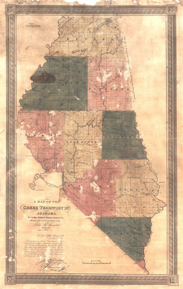
1833 Creek Indian territory by John LaTourrette (Alabama Department of Archives and History)
At odds with Federal Government
However, Governor Gayle of Alabama and the Federal government were at odds about the white settlers coming into the new territory contrary to the terms of the treaty with the Native Americans. The trouble was not settled until December of 1833, so the real organization of the county did not take place until 1834.
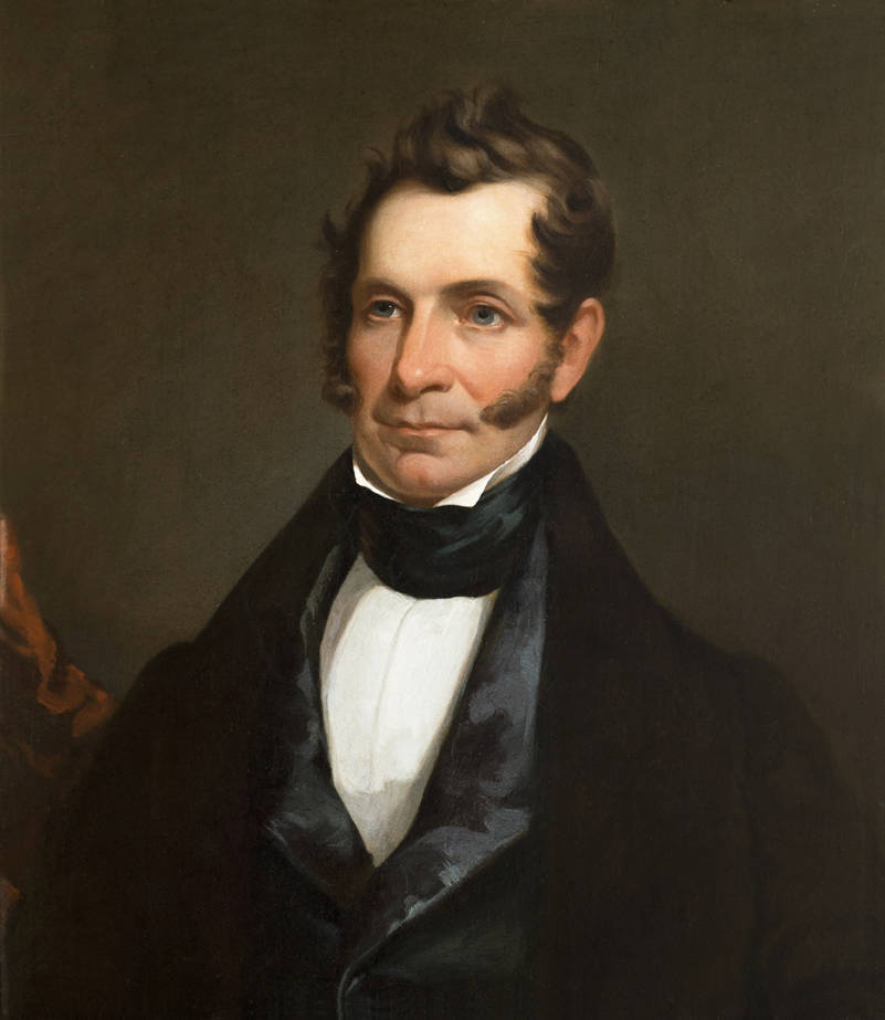
Official Portrait of Governor Gayle of Alabama
Lexington was the seat of justice
Robert W. Martin was the first judge appearing on the records. By an Act of the Legislature approved November 28th, 1833, Alfred Mahan, Larkin Cleveland, Simeon Chapman, and George Taylor were appointed Commissioners for Coosa County. They were authorized to locate, in connection with the county judge, the seat of justice and acquire by purchase or otherwise 160 acres of land to be laid off in suitable lots, to be sold at public sale after thirty days notice in two public newspapers, reserving such lots as would be needed for public buildings.
(NOTE FROM TRANSCRIBER: A site on Albert Crumpler’s plantation on Hatchemalega Creek was chosen as the county seat and given the name Lexington. In 1835 the name was changed to Rockford.)
It was required that the place was to be called Lexington, and was to be eight miles of the center of the county. They were also required to have an election held at the precincts, on the second Monday in February 1834, for a sheriff, clerk of circuit court, clerk of county court, an assessor and tax collector, and four commissioners of roads and revenues for the county. On the same day, Asbury Coker was appointed by an Act to take the census of the county.
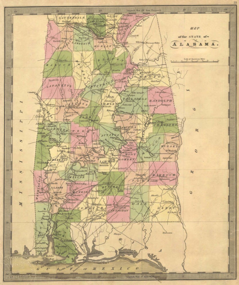
Map of State of Alabama 1835 by Jeremiah Greenleaf (Alabama Department of Archives and History)
County seat selected
On the 16th day of January 1834, an Act was approved authorizing the commissioners to select 160 acres for a county site under the grant of Congress, made in May 1824.
Election precincts were established at the houses of Solomon Bobbins Hugh McMillan, George Taylor, and Thomas Walstin, by an Act approved January 18th, 1834
In the absence of records it is presumed that the Judge of the county court had been appointed by the Governor and that the election provided for in the Act of November 28th, 1833 was held and the commissioners elected were: John A. Chapman, Larkin Cleveland, Thomas Lowery, and Jared B Townsend; and Albert C. Mahan, clerk of the county court. The first record book of the county shows these names: A R Coker was sheriff, J. P. Daniel, circuit clerk.
Officials appointed
The first records of the county show that a session of the commissioner’s court, in its first term, was held at Lexington in May 1834, and that Robert W. Martin was County judge; A. C. Mahan, county clerk; and John A. Chapman, Larkin Cleveland, and Thomas Lowery, the commissioners that were present. At this term, they appointed Gideon B. Benton as coroner; R. W. Cleveland, county surveyor; Thomas W. Walden, auctioneer; and Francis M. Hamilton, county treasurer. This is the only business recorded as being done at this session. This is from the records of the Commissioners Court of Coosa County, as filed in the Probate Office of the county. And what follows in regard to public roads and other matters are taken directly from the records of that office.
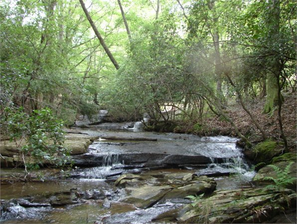
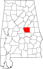
Present-day location of Coosa County, Alabama
Roads were established
The next term of this court was held August 19th, 1834, when a public road was ordered to be opened from Bait’s Ferry on the Coosa River, the nearest and best route to the county line of Coosa and Talladega to Talladega Town. Wm. A. Wilson, Thompson Coker, Abram Chancellor, Henry Logan, Archibald Downing, John Thomas, and John Cameron were appointed reviewers to mark out the road, and make return to the next term of court. This road still exists and is called the Bait’s Ferry Road.
This same term of the court ordered the opening of a public road beginning at the county line in the town of Wetumpka, and run then in a straight direction to the county line of Talladega County, at or near Thompson Coker’s, James Williams, George Lowery, John S. Baits, Enoch Autrey, Jessee M. Wilson, Albert Armstrong, and Joshua Monk were appointed the reviewers. This road is what is known as the Jackson Trace.
The same term ordered opening a public road beginning at the county line in Wetumpka, and thence in a straight direction to strike the county line of Talladega County at or near Kibbler’s old store. The reviewers were Charles Williams, George Lewis, David Lauderdale, James Spraggins, Solomon Robbins, Adam Harrell, and George Taylor. This is the road known as the Sockapatoy Road. A. R. Coker, sheriff, was required to serve notice on those appointed.
More appointments
At the December term of the court, Joseph B. Cleveland was appointed treasurer in lieu of F. M. Hamilton, who had resigned. At the same term of the court there is a notice that at the May term Thomas Walden, Alexander Black and John McKenzie were appointed commissioners of the sixteenth section of Township 23, R. 20, but the court being informed of the removal of Walden and McKenzie from the county, Josephus Lauderdale was appointed vice McKenzie and Charles Nix vice Walden.
At the February term, 1835, John Goodgame was appointed overseer of the poor for beat 4. The following sums were ordered paid the parties named for services from February 1834 to February 1835; A. R. Coker, sheriff, $50.00; J. P. Daniel, Circuit clerk, $50.00; A. C. Mahan, clerk, county court, $25.00; Geo. W. Jones, county baliff, $6.00; J. A. Chapman, court baliff, $4.50. This court also appointed William H. Ray a commissioner in lieu of Jared B. Townsend. George Lewis, A. C. Mahan and Daniel Robbins were appointed overseers on different parts of the Sockapatory Road; and Michael Reynolds on the River Road.
At the May term, 1835, the county tax was ordered to be raised from fifty per cent of the State tax to one hundred per cent. This term also ordered the opening of a public road from Rockford to the county line in a. straight direction to the Tallapoosa court house; and Fanch Cleveland, John Gilliard, James Goggans, George A. McDaniel, Wm. Patterson, George Melton, and T. T. Wall were appointed reviewers. A new road was also ordered from Rockford to the county line at Samuel Lovejoy’s, with Joseph Ray, James B. Morris, Adam Harrell, Jessee Bradshaw, Archibald Kimball, Samuel Lovejoy, and William Weaver as reviewers.
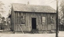
Rockford, Coosa County, Alabama (Landwatch.com)
More new roads
Also another from Rockford to House’s Ferry on Coosa River, with J. P. Daniel, R. W. Martin, W. H Ray, A. R. Coker, G. A. McDaniel, T. T. Wall, and A. B Hamilton reviewers. And another one from Rockford to Sockapatoy, and from thence to the nearest and best route to the county line, in a straight direction to the Randolph court house, with John Smith E.F. Heard, James Spraggans, Davis Campbell John Gilhard, Fanch Cleveland, and John A. Chapman to Sockapatoy; and from Sockapatoy to the county line, William Winslett, Charles Williams, Charles Nix, Isaac Lamb, Josephus Lauderdale, A. S. Elly, and Stephen Shelton the reviewers.
This court appropriated $125.00 for the purchase of books of record for the county. This court also appointed as managers of elections, at Rockford: T. T. Wall, Fanch Cleveland, and G. A. McDaniel; in beat 3, Wm. A. Wilson, Abram Chancellor, and John D. Wilson; at Moore’s Store, Wm. Richards, George Allen, and Russell Joes; and at Williams’ Ferry, James A. Wall, Isaac P. Pond, and Joel Spigener.
HISTORY OF COOSA COUNTY BY GEORGE EVANS BREWER, 1877
ALABAMA FOOTPRINTS – Volume I – IV: Four Volumes in One (Volume 1-4)
BUY ONE GET ONE FREE! The first four Alabama Footprints books have been combined into one book,
ALABAMA FOOTPRINTS Exploration
ALABAMA FOOTPRINTS Confrontation
From the time of the discovery of America restless, resolute, brave, and adventurous men and women crossed oceans and the wilderness in pursuit of their destiny. Many traveled to what would become the State of Alabama. They followed the Native American trails and their entrance into this area eventually pushed out the Native Americans. Over the years, many of their stories have been lost and/or forgotten. This book (four-books-in-one) reveals the stories published in volumes I-IV of the Alabama Footprints series.


$2.00 for how long ?
For as long as you want to be a Patron. You can stop at anytime. This link explains more about the program. http://www.alabamapioneers.com/did-you-know-we-now-have-an-interactive-level-on-alabama-pioneers/
Rev James Long Sloss pastored the Presbyterian Church in St Stephens and was affiliated with the Academy there in 1818, then went to the church in Cahaba when the capital was moved there.